
1. Improvement Location Certificate: The purposed of this document is to provide a map of the property which identifies any issues with encroachment. It shows all improvements and recorded easements on the property except for utilities. This is not a BoundarySurvey and is not intended to be used for constructing new improvements or fences, only to identify the location of existing improvements. Fees: Within Durango $300.00; 0-10 miles from Durango, $325.00; 10-20 miles from Durango, $350.00; over 20 miles from Durango, $375.00.
2. Boundary Survey: The purpose of this survey is to locate existing monuments that pertain to the property, replace corners that are not set and to show any monuments that may be placed in an inaccurate location. A plat is provided and it is a requirement of the surveyor to record a deposit plat with the county if any corners are set by the surveyor on a metes and bounds description or if pins are set within a subdivision which has a recording date that is older than twenty (20) years prior to the date of the boundary survey. Existing improvements are generally not shown, unless asked for, and recorded easements are shown if a title commitment policy is provided. Fees: based on total of fieldwork and drafting, $800 to $1200.
3. Improvement Survey Plat: This type of survey is similar to a Boundary Survey and all of the same rules apply, except that all improvements are shown, including fence lines. Fees: based on total of fieldwork and drafting, $800 to $1200.
4. Alta Survey: This type of survey is similar to an Improvement Survey Plat, except it is subject to guidelines required by the title insurance company and may include items such as underground utilities. All exceptions from the title commitment policy are shown on the plat and the survey data is subject to much more exact tolerances for setting and showing monuments related to the property. Fees: based on total of fieldwork and drafting and also the required information to be identified on the survey, $2500 to $3500.
5. Elevation Certificate: This is a document which shows various elevations of a subject property in relationship to the existing flood plane data. Fees: similar to those for an Improvement Location Certificate.
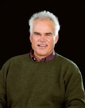
If you have any questions, please do not hesitate to call me. You can reach me, Don Ricedorff, at The Wells Group 970-375-7014, don@frontier.net, or at my website at durangorealproperty.com.
CRS, Certified Residential Specialist
CRB, Certified Residential Broker
CCIM, Certified Commercial Investment Member
CDPE, Certified Distressed Property Expert
ABR, Accredited Buyer Representation
GRI, Graduate of Realtor Institute
RSPS, Resort and Second Home Property Specialist
CIPS, Certified International Property Specialist
SRES, Senior Real Estate Specialist
He is also an active volunteer in the community and his church. His highest aspiration is spending time with his wife, Janet, and his three children Kelly, Katie, and Kyle. His other interests include playing tennis, fly fishing, hiking, boating, and water skiing.

No comments:
Post a Comment